


Next: Implementation
Up: DINSAR
Previous: Input Cards
Contents
In the defo processing result file for the products, the process control flag for dinsar
is switched on.
dinsar: 1
A complex real4 ('mph') file is created with the wrapped differential
phase. (The amplitude is the same as that of the original
'deformation' interferogram). A complex value (0,0) indicates
unwrapping was not ok.
If the the debug version of Doris is used (compiled with __DEBUG)
then ascii matrices are dumped for Linenumber, Pixelnumber, Bperptopo,
Bperpdefo, and Ratio.
Figures 31.1, 31.2, and
31.3 give example of output.
Figure:
Phase of complex 'topography' interferogram (flat earth
corrected, cropped). The area is dead sea Israel. Temporal
baseline is 1 day (tandem). The perpendicular baseline is
approximately 105 meters. This interferogram has been coregistered
on the defo pair (31.2) by tricking Doris.
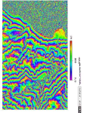 |
Figure 31.2:
Phase of complex 'deformation' interferogram (flat earth
corrected, cropped). The area is dead sea Israel. Temporal
baseline is 28 months day. The perpendicular baseline is
approximately -30 meters.
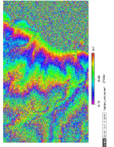 |
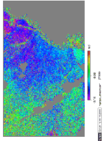
Figure 31.3:
Phase of differential complex interferogram (result of step
DINSAR, cropped). The area is dead sea Israel. The topography is
removed from the original interferogram (Figure 31.2)
by scaling the topography interferogram (Figure 31.1).
The perpendicular baseline is approximately 30 meters.
 |
Next: Implementation
Up: DINSAR
Previous: Input Cards
Contents
Leijen
2009-04-14