Jinhu Wang
Mapping, Laser Scanning, Point Cloud, Octree
Home
Publications
Projects
Gallery
High definition 3D map generation from point cloud data obtained by MLS system.
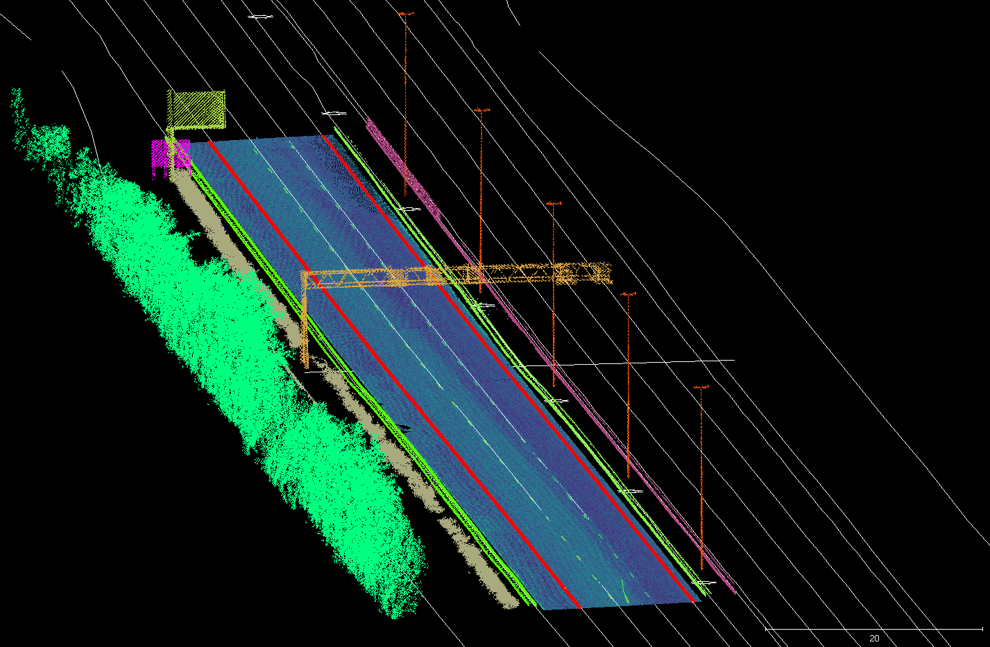
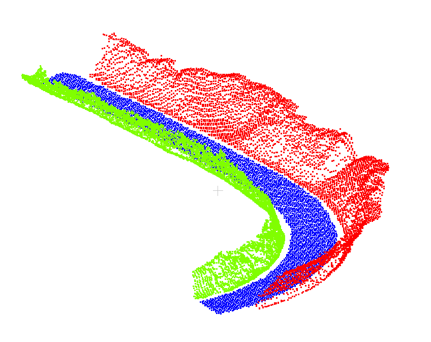
Automatic segmentation of road environment based on MLS point cloud data - 2.
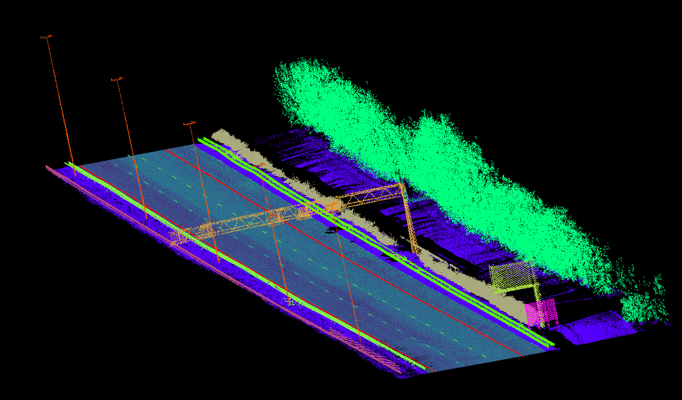
Automatic segmentation of road environment based on MLS point cloud data - 1.
High definition 3D map generation and updating.
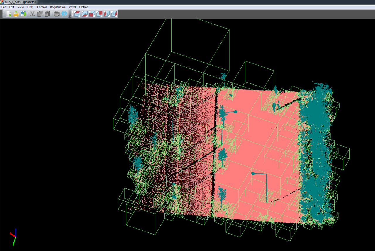
Scalable filtering of MLS point clouds.
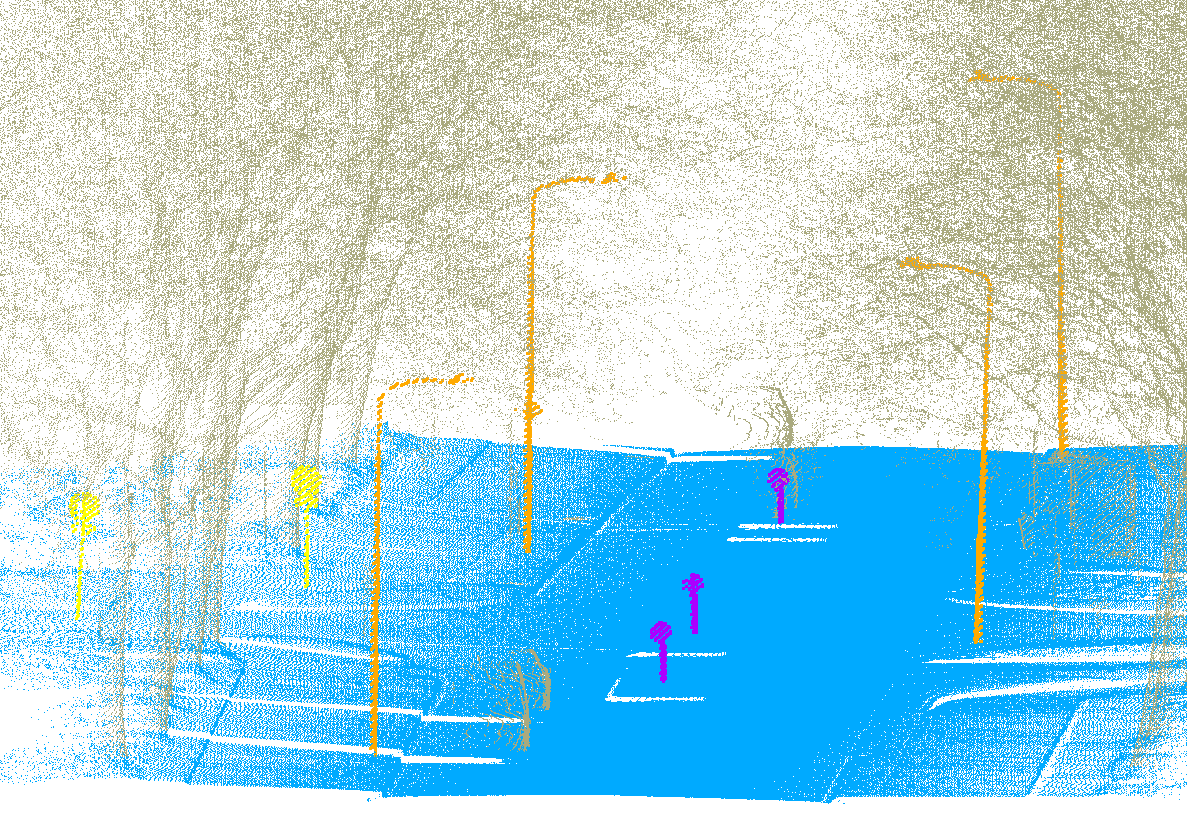
Roadside object recognition from MLS point clouds.
Tree species classification from MLS point clouds.
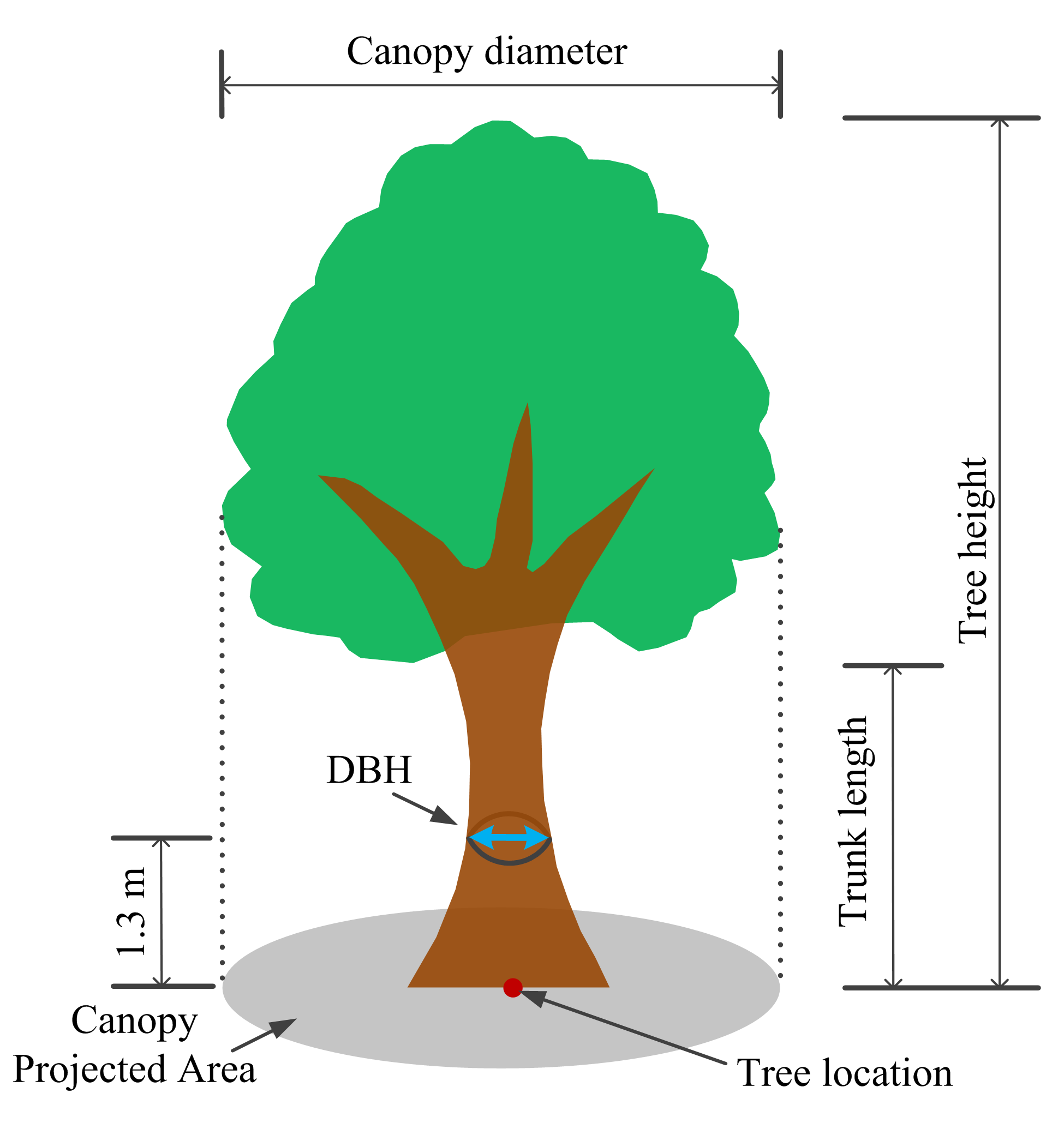
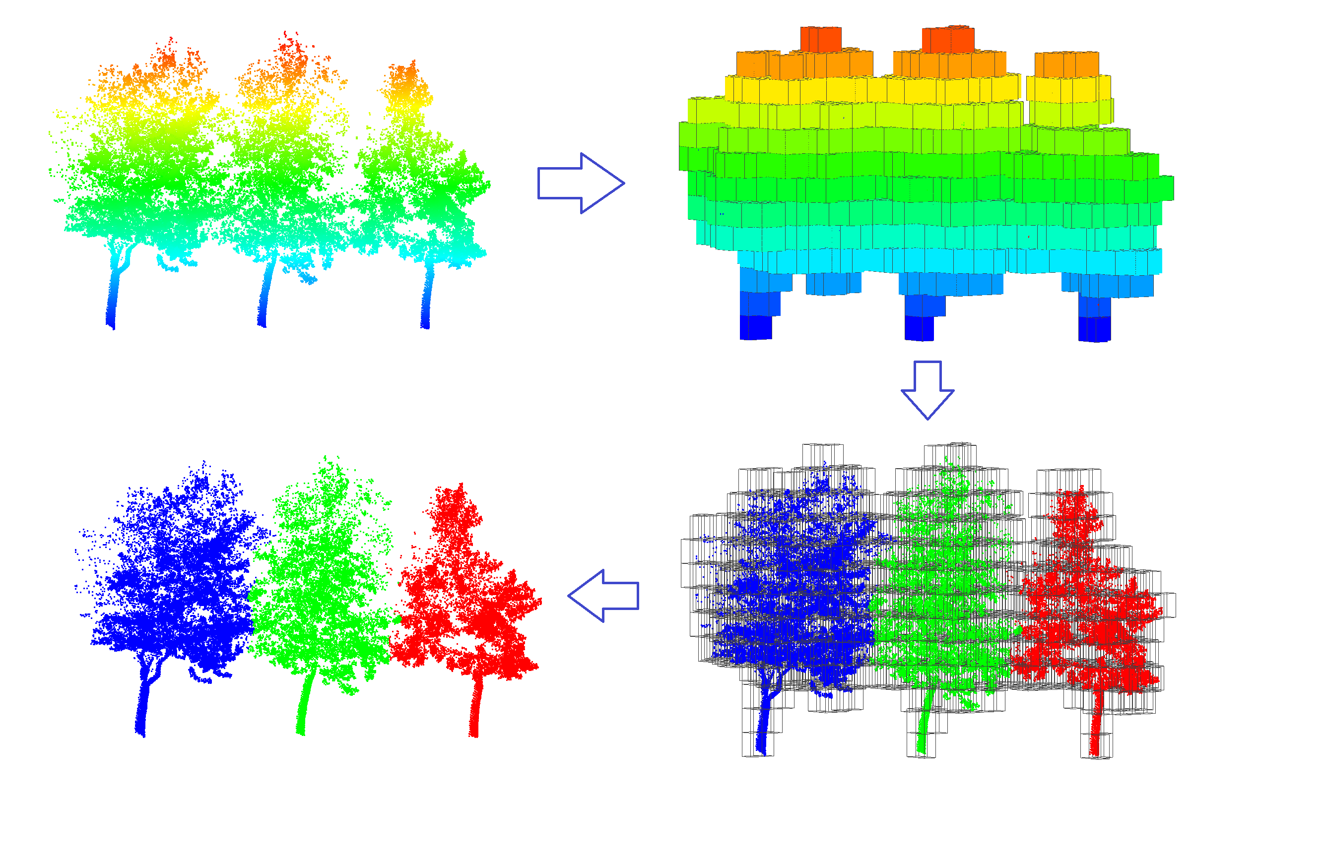
Urban and roadside tree individualization.
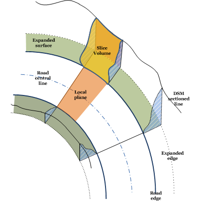
Estimation of road geometry.
Excavation volume estimation of road widening from MLS point cloud data.